Summary: Today we left the Sea of Galilee and headed North for about an hour to get to Hazor, Dan, Caesarea Phillipi, and Mt Bental. The region has two elevations. The lower part is called the Hulah Basin, the valley north of the Sea of Galilee. The mountains above the valley to the East are called Bashan in the Bible and the Golan Heights in modern times. The weather is clear and sunny but may deteriorate throughout the day. We are prepared for cool, wet weather.
Hazor: We started our day at the Old Testament site of Hazor. We had an excellent view of Mt Hermon, the high point of Israel, capped in snow and the Golan heights. We saw some gazelles running by (when you see deer mentioned in OT, this is the animal referred to). The reason we stopped here is that the city was very strategic. The international highway route was on the west side of the valley running right through Hazor during the Old Testament period. So Hazor was the entry into the land of Israel. It was called the Northeastern gateway. The route later shifted to the east side in the New Testament flowing instead to Bethsaida. In 2 kings 15:29 the Assyrian king (732 Bc) captured Hazor to secure the highway. They then went on to take the nearby valley, the Galilee and Gilead which was preparation for his later conquest of the rest of Israel and parts of Judah. The full Canaanite city was 200 acres, the largest excavated Tel in the country including an upper and lower city. This city during the Canaanite period dwarfed Megiddo and others. There was a library in hazor, which is the motivation for ongoing digs. Archeologists are hoping to unearth tens of thousands of cuneiform tablets. This far, they have only found a few of the tablets and Israelite artifacts in the upper city which shows that it became a smaller city after it was conquered by Joshua and fortified by Solomon.
Joshua 11 gives the account of Joshua’s conquest, which lasted about 7 years, and records Hazor’s destruction. The land was inhabited by Canaanites when Israel arrived. God told them to go to Shechem a place of covenant renewal to pronounce the curses and blessings. He had to conquer Jericho and then AI to reach it. This is referred to by scholars as the central campaign. He is tricked into making a treaty with the Gibeonites to the South and ends up having to conquer the South before going to Shechem as a result when the Gibeonites are attacked requiring Joshua to come to their aid (called the southern campaign). Joshua then turned north to Hazor, ruled by king Javin (northern campaign). Hazor was the largest city, and ruled the entire area. Caananites from Carmel, the Jordan rift, areas west of the the hulah basin, and from Mt Hermon all came to their aid. A huge territory and an enormous army from all the cities came. They gathered their army in modern Lebanon in a place called the waters of Marín up in the hills, essentially leaving the cities defenseless. Joshua took his warriors, went to them, probably surprising them, and wiped out their army. He then captured Hazor, killed the king and the cities inhabitants, and burned the city with fire. There is an archeological debate around hazor surrounding the dating of various burn layers and how they relate to biblical chronology. Here is a picture of Shiloh pointing to one of them that is exposed which supports the 14th BC century exodus that follows biblical chronology.

The site remained strategic to Israel since it was the gateway into the land and was later fortified Solomon. The Bible mentions that he built the temple, and his house, and also fortified the strategic cities of Jerusalem, hazor, meggido, and gezer. Here is a picture of the walls of the gate that Solomon built. The Gate had 6 chambers. Notice they were hollow, and could be used for storage during times of peace. During war they were filled with dirt and rocks to have a thick wall. Similar gates are found at the other sites mentioned. Here is the biblical account:
“And this is the account of the forced labor that King Solomon drafted to build the house of the Lord and his own house and the Millo and the wall of Jerusalem and Hazor and Megiddo and Gezer” – 1 Kings 9:15 ESV

Dan: We drove another 30 minutes north along the ancient highway and then turned East to Dan, an Old Testament site. Dan is the Northermost area in Israel, so the Bible frequently refers to “all of Israel, from Dan to Beersheba” with Beersheba in the South. The city was inhabited back in Abraham’s day. Abraham passed here as he followed the international highway over past Damascus to rescue Lot who had been captured by kings (genesis 14). We didn’t stop but there is an impressive gate uncovered onsite dating to around the time of Abraham. Dan is a city but it is also a tribe. Judges 18 tells the story of how Dan ended up in the North. Basically the tribe was unable to or did not want to conquer the coastland that they were given by God, so they moved North and found this city called Laish relatively undefended and conquered it instead. There are 5000 gallons of water per day flowing from 4 springs near Mt Hermon. One of them one is Dan. They feed the Jordan and flow South from here towards the Sea of Galilee. In fact the Jordan River literally means “river of Dan.” Here is a picture of us in front of some of the roaring springs. Cheerio was fascinated:

Dan is known for the cultic worship center setup by Jeraboam son of Nebat who “caused all of Israel to Sin” because he setup a site here for Jews to worship a golden calf so they would stop going to Jerusalem to worship after the northern kingdom split from Judah. 1 Kings 11 gives an introduction to him, his rebellion, and a promise from God available thru obedience. In 1 Kings 12:26 Jeraboam rejects the promise and instead sets up a temple in Dan to compete with Jerusalem for worship, disobeying God. He also setup his own priesthood and made his own calendar of feasts. In chapter 14:1 he names one of his sons abihu, “my father is the Lord” and another in vs 20 “nadab”, the names of Aaron’s sons implying he was equal to Aaron the first high priest who also setup a golden calf that Moses destroyed. His religion had a form of godliness (only using kosher animals in their sacrifice as demonstrated through archeology) but none of it was according to Gods word. The archaeologists found the worship area and also tools nearby used in the sacrifices. For this picture we are sitting on a set of stairs leading up to where the idol was placed. The sacrifices would have occurred on the alter before the idol.

Leaving Dan we passed out of the city gate. Important decisions always took place in the gate, with elders conferring on the issues. In this gate archaeologists found a basalt slab dating to the 840’s BC when the Aremeans attacked Israel. 1 Kings 15:18-20 tells of the destruction of Dan mentioned on the slab which is inscribed ”…And Hadad went in front of me and I killed 70 kings, and I killed… Ahaz king of the house of David”. This is important because it is one of only two extra biblical sources demonstrating that David existed. Here is a picture of John Black, our trip leader, explaining the significance of the find.

Caesarea Phillipi: Leaving Dan, we climbed up to a New Testament city called Caesarea Phillipi. Named in honor of Philip, the son of Herod the great, who ruled this area. It was an extremely pagan area with a huge rock, the largest in Israel, with niches carved with gods, including one to the god Pan. Jesus came here to get away from the religious Jews who wouldn’t come to such a pagan place to spend time preparing his disciples for his upcoming death. It was here that peter confesses Jesus to be the Christ, and where Jesus confirmed that He was the messiah. The visit is recorded in Matthew 16. Jesus calls Peter a rock with this city as the backdrop. Psalm 18 says god is my rock. This was a turning point of his ministry. He is then transfigured, very likely right on top of the mountain backdrop in this picture the highest nearby place. Beginning here, Jesus began telling of his death, burial, and resurrection. The pagan Romans then built temples in this area. Herod’s was found about 2 miles from here at a site called Omrit in 1998 when a brush fire uncovered it. Philip probably built one where we took this picture when he made it his city.

Lunch at a Druze restaurant: We had lunch at a restaurant operated by Druze. Druze are a religious group that split from Islam and are considered heretics by Muslims that live in the hills in Northern Israel and Southern Syria as well as Lebanon and a few in Jordan. One of their major beliefs is that the Messiah will be born to a man at an unknown time. The men take precautions and wear pants with a dropped seat just in case. They also believe in reincarnation so therefore, no one can convert to become druze. This combined with the complex geopolitics of where they live make finding a spouse tricky.

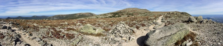
Mt Bental and the Golan Heights: For the final stop of the day we headed to Mt Bental, a dormant volcano with an overlook into Syria. We crossed the Golan heights, an agricultural plateau in the northeastern part of Israel that was captured from Syria in 1967. The climate here is similar to Europe, with orchards of apples and cherries and some vineyards. The plateau sits high above the Sea of Galilee and the valley. From here, Syria was constantly attacking Israeli farmers below until the territory was captured. They also started digging a channel to divert the water from this area which would have robbed Israel (and the Sea of Galilee) of its water supply. Israel could not guarantee its safety without the Golan Heights. President Trump recognized them as part of Israel recently, something the international community has avoided. In his honor, they have named a new settlement after him in the area we were called “Trump Heights.” In 1973 during Yom Kippur, Syria attacked again, and about 800 tanks tried to enter Israel at the foot of this mountain. It was a complete surprise. There were 12 Israeli ones here for defense. Humanly speaking it was impossible, but God turned the Syrian army around, a modern miracle. His eyes are still on this place and He is not done with His people. They call the place the valley of tears and it was just below us.
The other distinctive feature of the Golan heights is patches of tall trees. Eli Cohen was born in 1925 in Egypt. He came to Israel in 1960’s and quickly became a spy for Israel, moving to Syria. He convinced the soldiers to plant trees around the bases for shade because it is hot, so that eventually Israel would know the location of all the military installations. To this day there are clusters of trees visible. He was discovered and publically hanged in Damascus in 1965. There is a movie about him called “the spy”. Here is a view from the top of Mt Bental:

Hike the Good Hike!
Sherpa and Porter (and Cheerio)
